The Dirt.Simple Express - Fall 2015
Cut/fill grid on your phone!
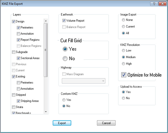
In the latest version of Earthwork 4D, (available here) the cut/fill grid will now be exported to a KMZ file to be viewed on Google Earth or used in the field with SmartPlan. The cut/fill grid is in a separate layer that may be viewed independently or in combination with the color cut/fill map or plan sheets. View the KMZ file on your phone or tablet as you walk the jobsite with SmartPlan. Click here to view a video on all the new features in the latest version.

SmartPlan may be used with your Apple iPhone or iPad, as well as Android devices.
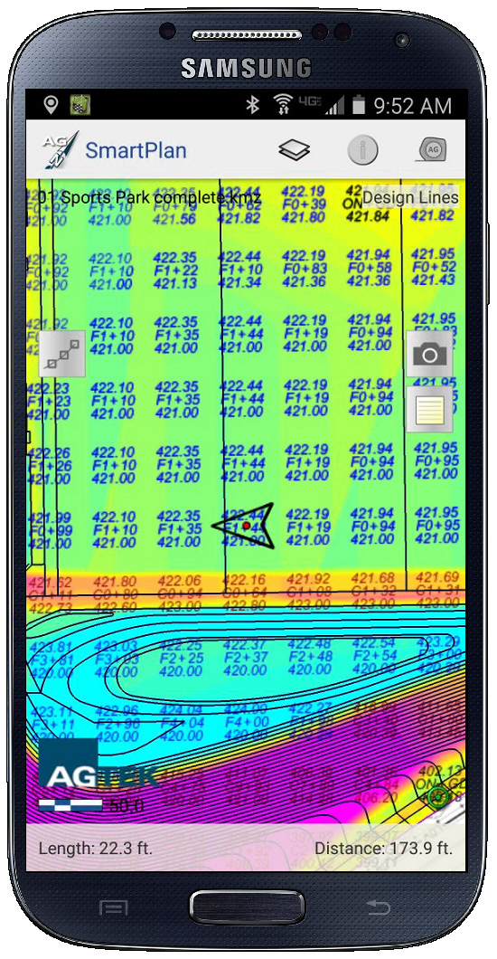
View the cut/fill grid in Google Earth to assist in analyzing the earthwork.

The latest version has also added the option to Optimize for Mobile when exporting a KMZ file to be used in the field with SmartPlan on your phone or tablet. Use this option to maintain a higher resolution of the plan sheets when viewing them on your phone.
Need "Help" with Earthwork 4D?
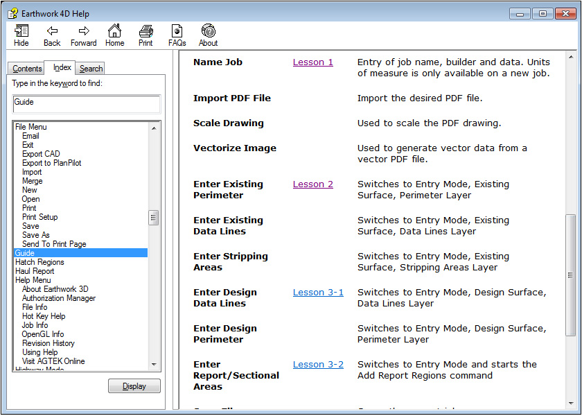
In the latest version of Earthwork 4D, the help topics have been updated to include video links to the online tutorials. There are several ways to access the help topics. Click the question mark on any dialog window to access the help. On some dialog windows, click the Help button.
Click the video links to access the online tutorials. You may also select the Help menu and select Earthwork 4D Help to list all the Help Topics.
New interactive stake list editor
In the latest version of Earthwork 4D, the Stake List Editor has been added to allow users to create a stake list of points to be used in the field for staking and layout. The Stake List Editor may be moved to a separate screen or docked to the side of the main screen. Select the desired point to be added to the stake list. Use the offset guides to add the offsets at the desired distance and angle from the selected point.
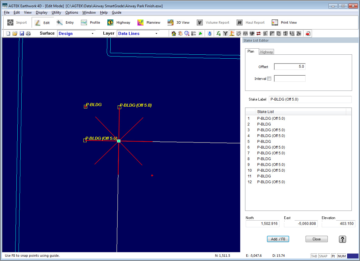
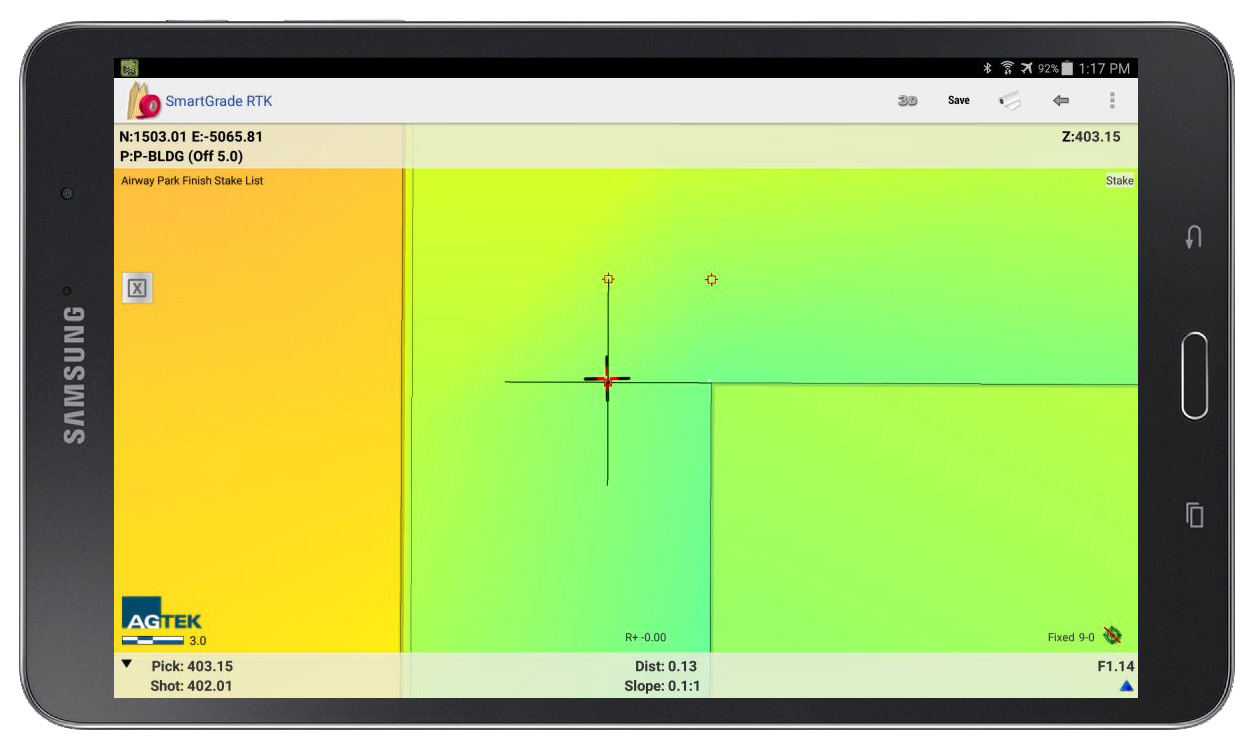
Use the stake list in the field with SmartGrade to stake the desired points. You may also export the stake list to be used with your third party GPS software.
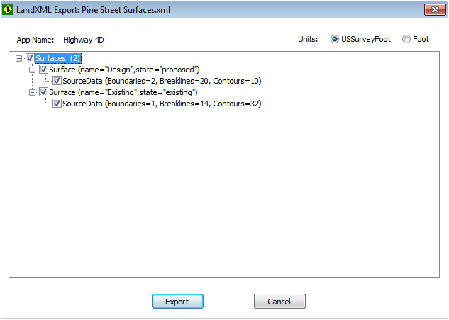
Export surfaces to LandXML
In the latest version of Highway 4D, you may now export the 3D surface data to a LandXML file. This file may be imported into other third party engineering or survey software. Export your GPS models to third party machine control systems. Select the File menu and select Save As. Change the file type to LandXML file. Select the desired surfaces to be exported. The XML file will contain contours, breaklines and perimeters.
Follow AGTEK on LinkedIn . . .
To follow AGTEK on LinkedIn, click the link ![]() on our homepage at www.agtek.com to get familiar, or click here to join the AGTEK Users Group.
on our homepage at www.agtek.com to get familiar, or click here to join the AGTEK Users Group.
Get trained on AGTEK!
There are currently three options to receive training on AGTEK software:
- You can sign up for training via the internet and complete your one-on-one training from the comfort of your own office. All that is required is the AGTEK software you wish to be trained on and a high-speed internet connection.
- Michael Cope is an authorized independent AGTEK trainer who offers regional seminar style classes across the country.
- View the online videos to train yourself at your own pace. Click the desired program, then choose the topic.
Get Technical Support!
You may still renew your AGTEK Support Subscription. An AGTEK Support Subscription has many benefits, including:
- Access to the latest improvements and updates for your AGTEK software.
- Access to our very experienced and knowledgeable technical support through phone and email.
- Assistance with plan files in a variety of formats.
- Access to video tutorials on how to use all the power of your AGTEK software.
- Assistance optimizing your 3D site models for GPS machine control.
- Experienced GPS troubleshooting and application advice.
To sign up, please fax back your renewal letter or contact SubscriptionRenewal@agtek.com
Get current versions!
| Program | Version | Date Released |
| Earthwork 4D | 1.17.2 | 10/12/2015 |
| Materials/UG 4D | 1.13 | 9/2/2015 |
| Trackwork 4D | 2.13 | 9/30/2013 |
| SmartPlan | 1.2.2 | 8/12/2015 |
| SmartDirt | 1.9 | 10/12/2015 |
| SmartGrade | 1.5.2 | 8/12/2015 |
| SmartBlade | 1.0.2 | 10/12/2015 |
| Earthwork 3D | 1.79.2 | 4/27/2015 |
| Highway 3D | 1.79.2 | 4/27/2015 |
| SiteModel 3D | 1.79.2 | 4/27/2015 |
| SiteModel-Highway | 1.79.2 | 4/27/2015 |
| SitePlan 3D | 1.79.2 | 4/27/2015 |
| GradeModel | 1.79.2 | 4/27/2015 |
| Materials 3D-UG | 1.67.2 | 4/27/2015 |
How do I tell what version I have?
Open the program and Select Help>About Program Name from the menu.
How do I get the latest versions?
AGTEK Support subscribers can go to the Support - Downloads page and click on the desired program. Click the Download button to start the download and save the file to a known location. When the download is finished, double-click on it to start the installation program. Follow the installer directions to completion. A backup copy of the download can be saved on a thumb drive or CD for future use.
If you are not an AGTEK support subscriber, please click to ask for more information.