Jobs | 925.606.8197
©2023 AGTEK Development – Part of Hexagon. All rights reserved
Press | Privacy | Code of Ethics

DOT's are now providing a wealth of 3D data to contractors. Making it easier than ever to plan and construct projects effectively while reducing risk with significant savings of time and money.
Bids are closing on the 14th of September for an upcoming 2.7 mile road upgrade and extension in the County of Mobile, Alabama. With an estimated value of around $34 million and duration of 450 working days, we've looked at the data available to estimate and validate the work required.
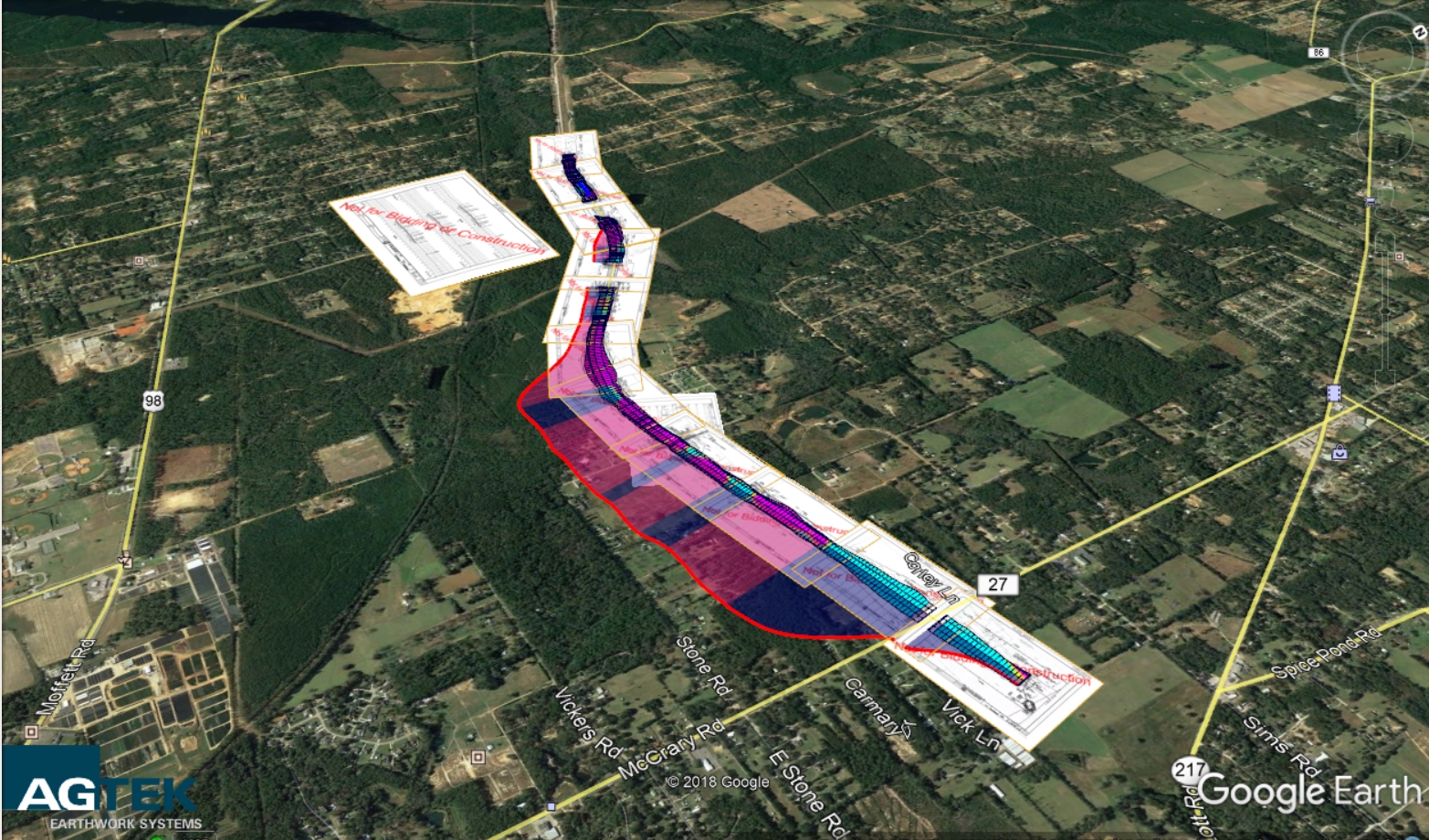
Digital data for the project can be found on the Alabama DOT website at: https://alletting.dot.state.al.us/All_2018_Letting_Files/LettingFiles_091418.html. The digital design data was processed by AGTEK’s support team and easily read into the Earthwork 4D suite and combined with other project data to generate digital cross sections to determine the extent of earthwork required.
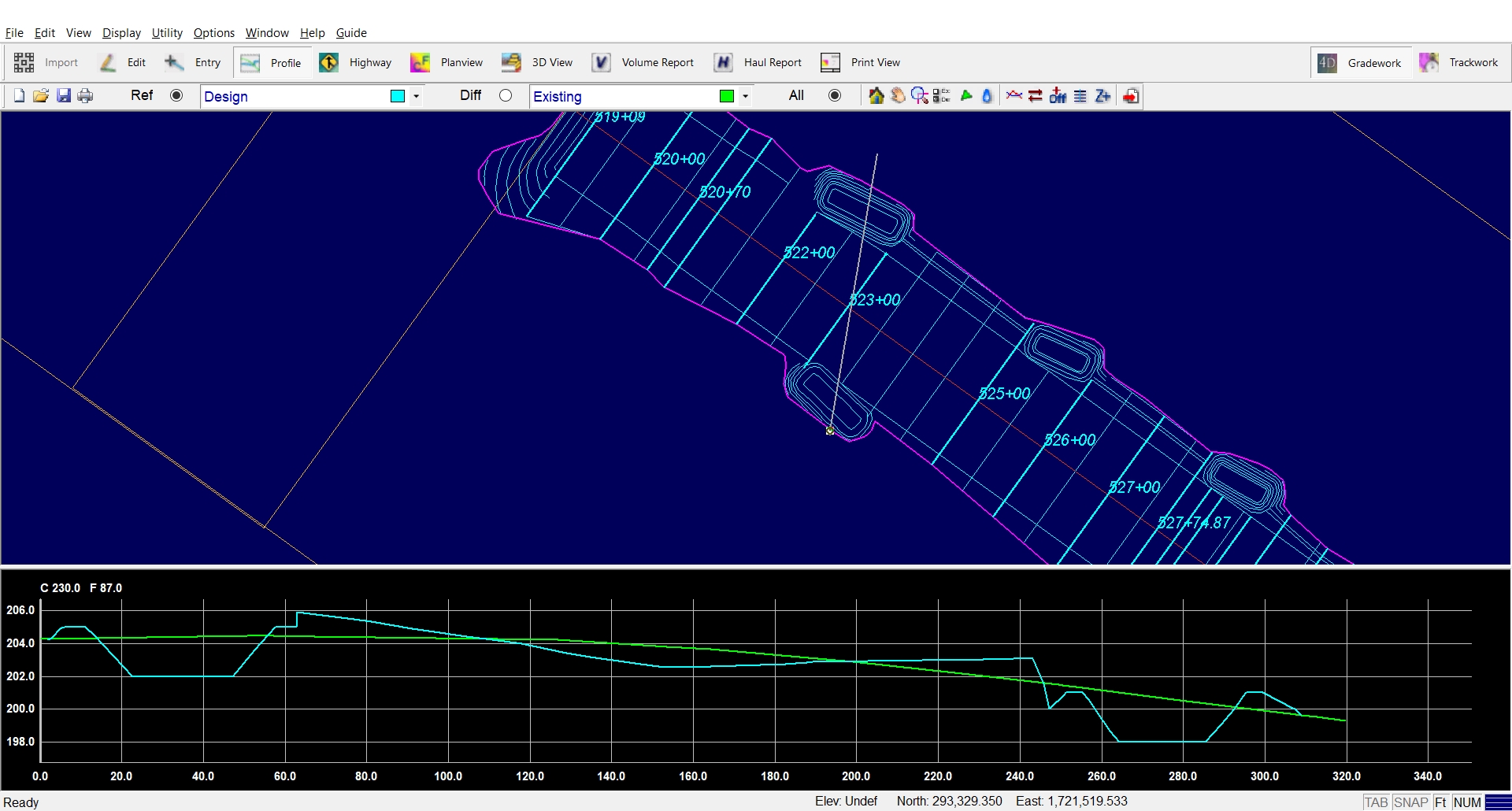
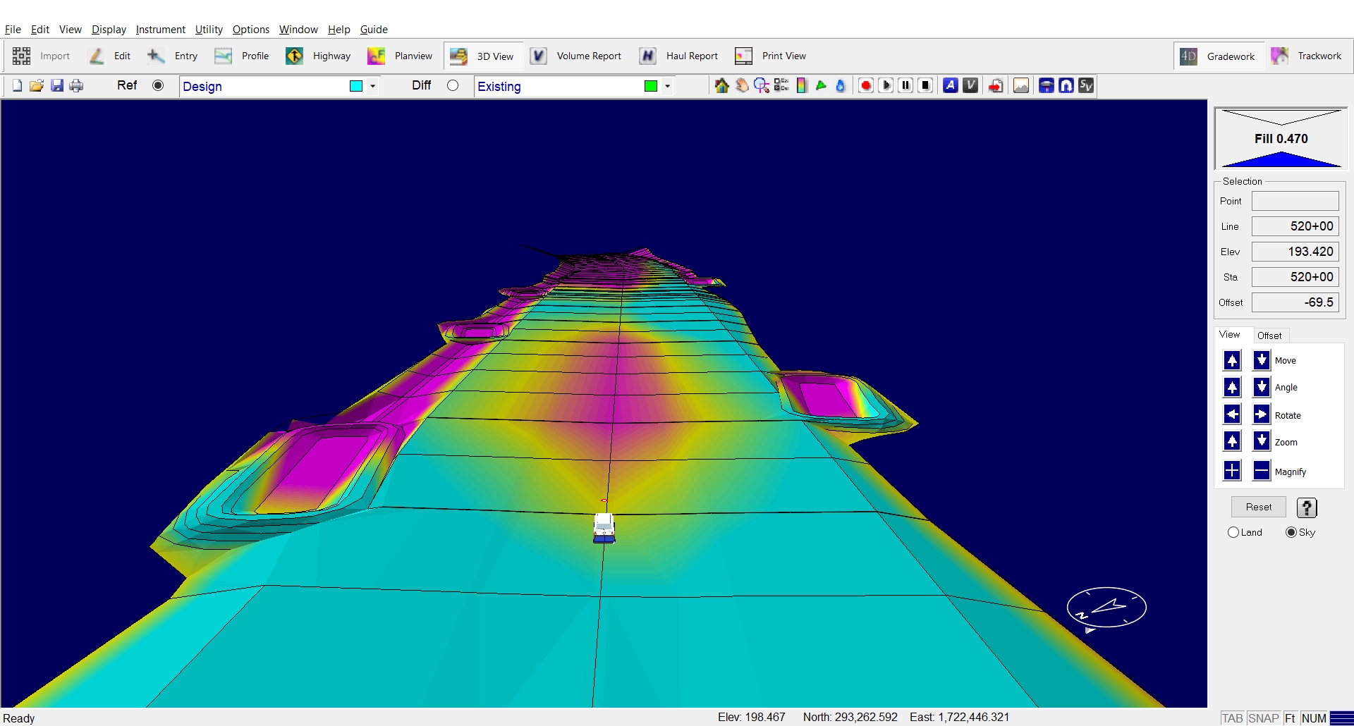
Extensive validation tools are available to visualize and process the data in profile, plan, cross section and 3D views, optimizing the construction process and ensuring all bid details are accounted for. It's estimated that 490,000 CY of unclassified material will move throughout the project duration.
Geo-referencing the plan sheets and exporting the data to mobile apps enables for a thorough site walk and evaluation prior to the final bid submission. Notes, photos and haul paths can all be tracked to refine the bid details and balance areas can be calculated in the field.
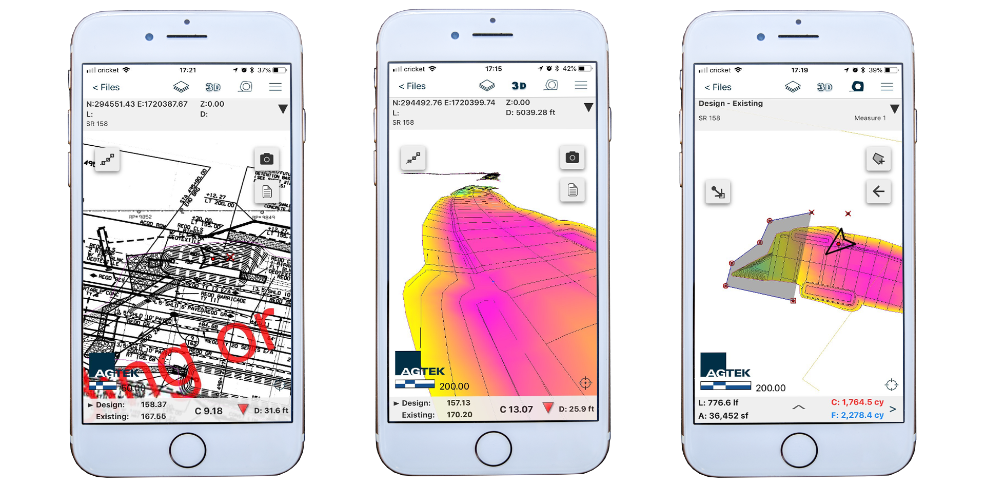
Like many DOT’s around the country, Alabama is working to provide digital data in a form that is easily used within AGTEK software for bidding and construction. PDF plan sheets are merged with centerline alignment and cross section details to quickly produce a model that can quantify the work by phase and scope of construction. The same data can be made available to mobile devices in the field for pre-bid site inspections and validation and used by machine control systems once the bid is won.


Jobs | 925.606.8197
©2023 AGTEK Development – Part of Hexagon. All rights reserved
Press | Privacy | Code of Ethics
 Contact Us