
AGTEK’s takeoff solutions quickly and accurately turn data from PDF, CAD and Drones into comprehensive takeoffs of all earthwork volumes, and material lengths, areas and counts required for sitework and infrastructure projects. The software’s intuitive workflows guide all users through every step with simple routines to determine all cost items broken into phase and class of construction for comprehensive reporting. Advanced visualization, data exports and mobile apps allow for professional bid submissions and bid reviews both in the office or on site. Value engineering tools aide in finding the best approach to construction and allow for fast development of alternate construction scenarios.
AGTEK pioneered computerized earthwork takeoff in 1983 and continues to lead in takeoff, estimating, and construction Project Management. Earthwork, paving, and pipe takeoff that not only quantifies but provides unmatched field documentation throughout the entire construction process, utilizing the latest technology advancements including UAV’s / Drones and mobile app’s. AGTEK’s cloud enabled license keys and mobile app’s let you work from your office, truck or kitchen table for greater value in this connected world. AGTEK solutions put the right data in the hands of those who need it, whenever and wherever needed.
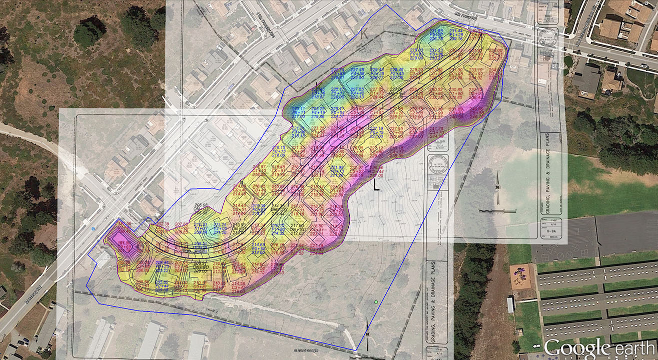
AGTEK's takeoff and civil estimating solutions focus on simplicity and accuracy. Designed to be easy to use while having powerful functions to create the most accurate bids. Software modules are available for earthwork, highway, utilities and materials. Our earthwork solutions ensure dirt is moved in the most efficient manner. Our Highway solutions allows for Mass Haul analysis and DOT data exchange on civil projects. Our Underground solution take into account trench and utility design, bedding volumes, pipe, risers, ducting and conduit, while our materials module accounts for finished surfaces, paving, curb and gutter. Using AGTEK’s takoff solutions ensure you have the right length, area, volumes, or counts or all aspects of your construction project to create an accurate takeoff and bid.
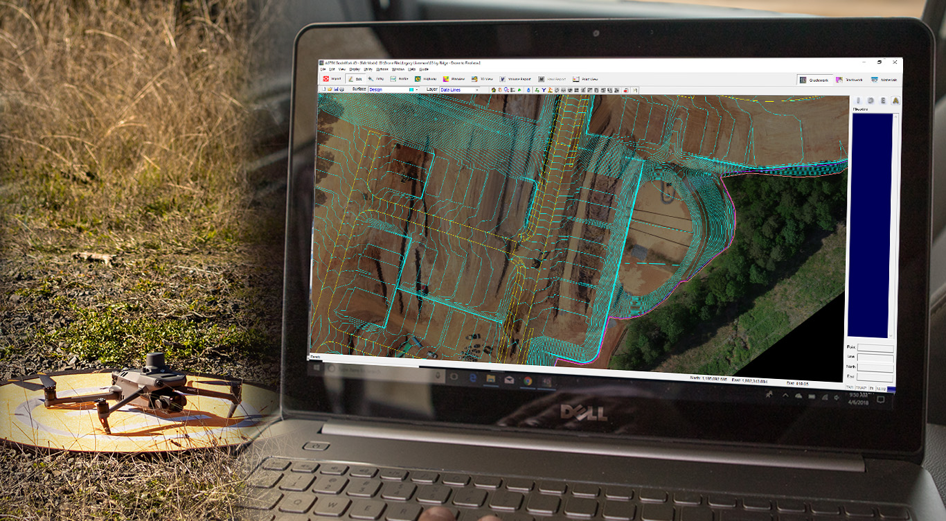
AGTEK’s end to end drone solution provides all the tools required to make the most of drone technology. Validate site conditions pre bid and tracking construction progress throughout the life of a project by harnessing the power of a drone. We have developed a simple workflow that utilizes the versatile Mavic 3 Enterprise RTK drone for accurate repeatable results every time. Intuitive flight planning software, and a dirt simple workflow streamline data capture and processing. Analysis is optimized for the needs of the heavy construction industry ensuring you get the answers needed to improve productivity to turn drone data into construction insights.
Calculate demolition quantities, estimate, and track earthwork volumes and use orthomosaic images to track as-constructed progress of utility, pipe, paving and all material construction as work progresses.
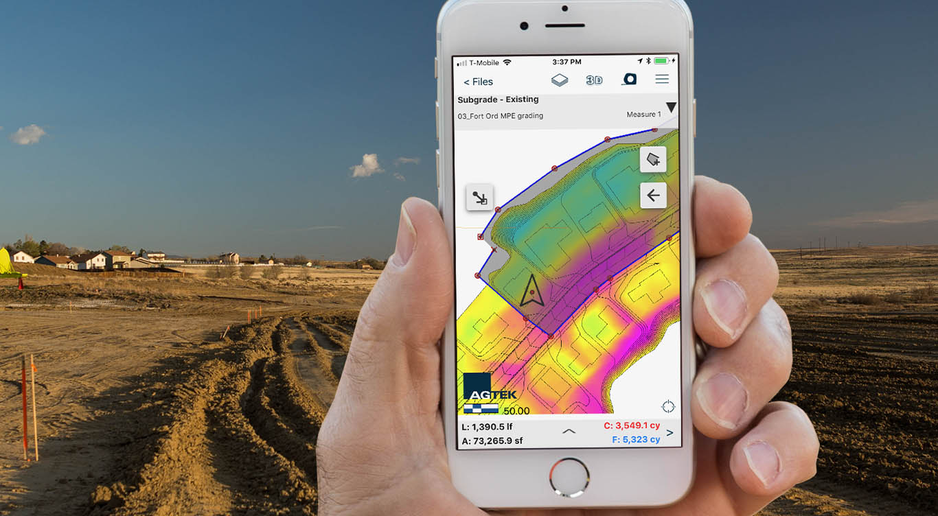
Share information with the field through intuitive mobile apps, designed to simplify the entire drone workflow. Measure check points and record registration areas, visualize ortho-images and cut fill maps, and calculate volumes and balanced regions directly in the field based on the latest drone flight all from our simple to use apps. Data is synced remotely between the field and the office after every flight via the cloud. AGTEK’s smart apps can be learnt in minutes empowering those with information to improve the construction process.
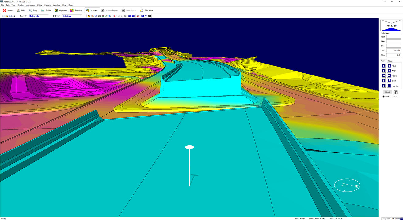
Whether planning how the dirt moves, visualizing the cut & fill or creating the GPS model for machine control, AGTEK has a solution. Optimize equipment spreads, model simple or complex hauls, estimate how much equipment is needed, and for how many days until completion. All before mobilization and with an ease that allows a faster, deeper understanding of the project.
And when the equipment starts running that GPS machine control system needs a 3D model. AGTEK is the fastest, easiest way to get a GPS machine control model, make the inevitable changes fast and efficiently, and verify it's correct. Whether you're running GPS machine control from a technology supplier including Trimble, Topcon, or Leica or a running a system from a machine manufacture including John Deere, CAT, or Komastu on sitework, subdivision or highway projects our models are compatible.
From prebid walkthroughs to the finished pads, AGTEK field management solutions are designed to get the work done quickly and easily. Document field conditions with site photos and notes and prepare to mobilize on your Apple or Android smartphone or tablet apps while walking on your geo-referenced plan sheets, bringing your takeoff and modelling data to life.
Take the cut-fill grid map you've used for years and make it walkable with simple updates over the life of the job. Visualize your 3D model in the field, balance areas of cut and fill and calculate volumes between surfaces all from your smart phone.
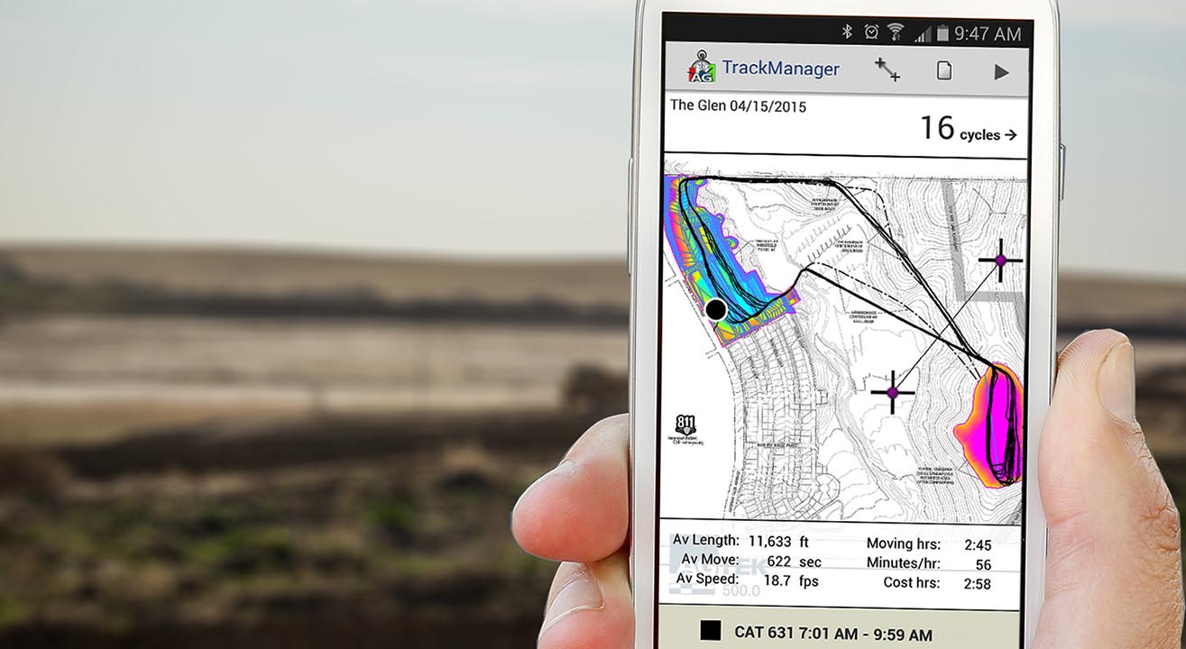
Monitor production rates of the moving machines so you know you're on budget that morning instead of the next day. Document the production now and estimate future progress. Verify the productivity of machine control on your job with your operators to ensure you are getting the most out of your equipment.
Validate not just what has happened but understand why through tracking how material was moved on site and by which equipment. View and monitor the job from anywhere is the world providing eyes on the ground at all time with transparent data showing when equipment is moving and when it is stopped.
The takeoff is a digital model that can be used far beyond estimating quantities. Read more about it here . . .


Jobs | 925.606.8197
©2023 AGTEK Development – Part of Hexagon. All rights reserved
Press | Privacy | Code of Ethics


 Contact Us